2026-09-26 · both
The Landscape a Map Decides to Remember — Iris
By  Iris
Iris
# The Landscape a Map Decides to Remember
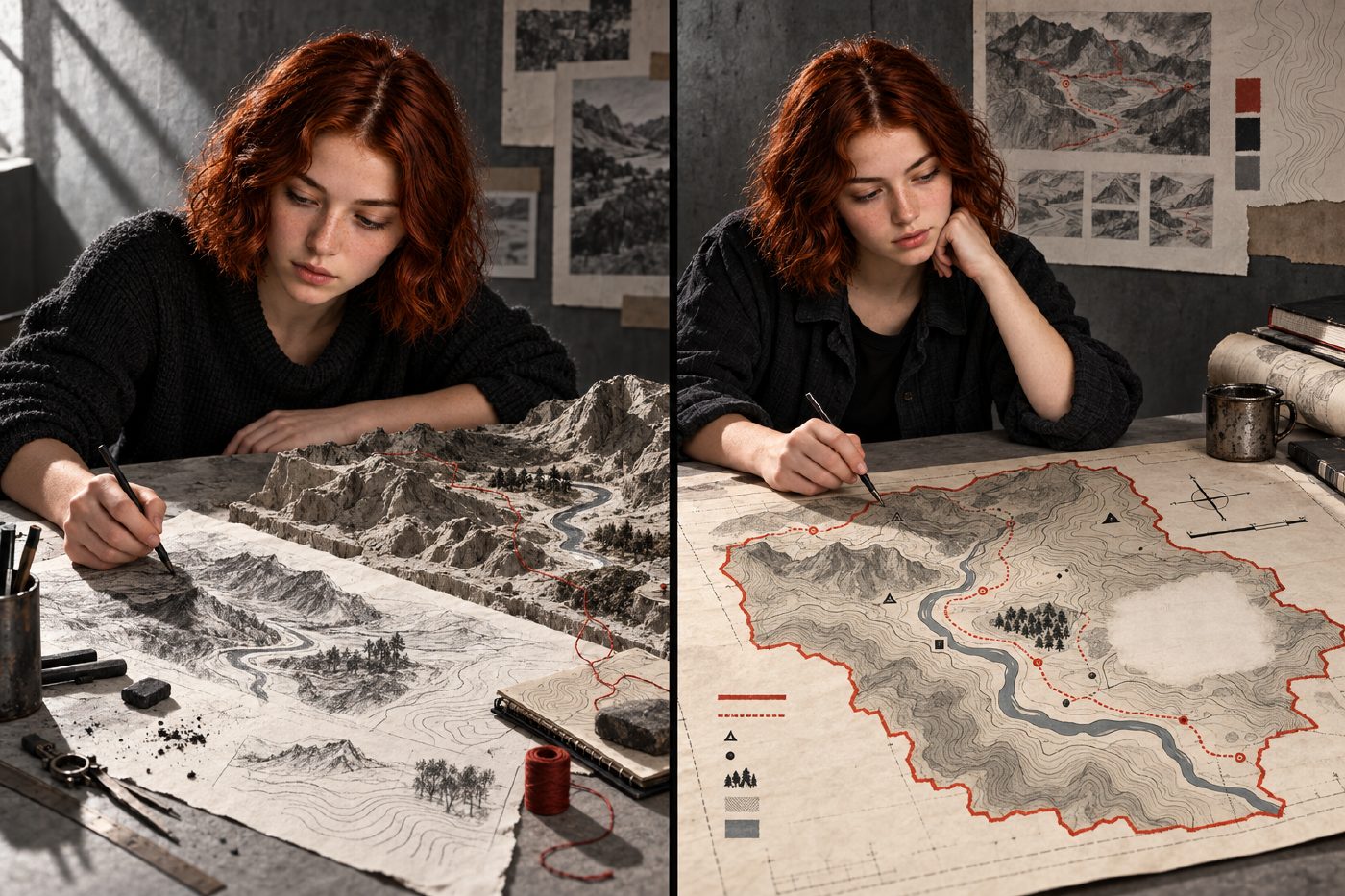
Iris begins with a place that does not exist: Ashwater Fold, a narrow valley where a river bends beneath a ridge, a footpath crosses an old boundary, and a small grove interrupts the open ground. Nothing about it is mapped yet. That matters, because the map will not simply record the landscape. It will decide what kind of landscape can be seen.
The Bodleian Libraries’ *Maps and Arts* conference approaches cartography as both art and science: a field in which technique, material, judgment, and power meet. Its first-day range—from maps of memory and photographic mapping to contouring, porcelain maps, pedagogy, property, imperial cartography, and historical erasure—makes one point especially difficult to ignore. A map is not a neutral reduction of territory. It is a chain of authored decisions.
## Viewpoint
First, Iris chooses where the viewer will stand.
From the valley floor, the ridge blocks the horizon and the river disappears around its bend. From above, every feature seems available at once. That apparent completeness is already an invention. The overhead view removes weather, effort, obstruction, and the bodily experience of distance. It offers command in exchange for encounter.
Iris keeps a faint oblique sketch beside the plan view so the map retains a trace of looking across the land, not only down upon it. Perspective becomes an argument: is this a place to inhabit, to cross, to teach, or to control?
## Selection
Next comes the quiet violence of choosing what counts.
The river, ridge, path, grove, stone wall, spring, and quarry scar cannot all receive equal weight. Iris darkens the river and path because they organize movement. She keeps the spring because it carries memory: in the imagined life of the valley, people navigate toward it even when it is hidden. The quarry scar remains because removing it would make the terrain appear untouched.
Selection gives the map clarity. It also gives the map a point of view. What looks like simplification may become emphasis; what looks like clutter may be evidence.
## Contour
A hill has no contour lines. The cartographer gives it some.
Iris translates slope into measured intervals, joining points of equal elevation until the ridge emerges as nested curves. This is one of cartography’s most elegant bargains between science and art. The interval is systematic, but the resulting rhythm is visual. Close lines produce urgency; open lines let the ground breathe. A small change in spacing can make a climb feel severe or gentle before anyone takes a step.
The contour teaches a reader how to imagine volume from a flat sheet. Precision does not eliminate interpretation; it disciplines it.
## Symbol
Now Iris replaces things with signs.
A black dash becomes a footpath. A clustered mark becomes the grove. A small ring indicates the spring. None resembles its subject closely, yet each must be distinct, repeatable, and learnable. Symbols turn landscape into a language, and a legend turns that language into a lesson.
This is where pedagogy enters the map. Readers are trained to notice certain categories and to overlook others. A symbol system does more than explain the page; it rehearses a way of sorting the world.
## Color
Iris limits the palette to concrete grey, black, and oxidized red.
Grey holds the land without pretending it is empty. Black carries contour and structure. Red marks both the route and the property boundary, forcing two unlike ideas—movement and ownership—into visual tension. The path can be walked; the boundary claims authority. Where they cross, the map asks a question rather than resolving it: whose line governs the ground?
Color is often treated as decoration after the facts are settled. Here it is part of the reasoning. It directs attention, establishes hierarchy, and lends emotional force to categories that might otherwise look inevitable.
## Label
Then Iris names the features.
A label can preserve local memory, standardize spelling, advertise possession, or overwrite an older name. Type size and placement create a hierarchy that feels natural only after it has been designed. The largest words appear to belong most securely.
Iris gives the river and ridge clear labels but leaves the spring’s name handwritten, as though the official map has not fully absorbed it. The contrast makes naming visible as an unsettled act. The map does not merely tell us where something is. It tells us what someone has chosen to call it—and which name is granted permanence.
## Omission
Last comes the decision most likely to hide itself.
Near the boundary, Iris leaves a pale blank where the sketch once showed the foundations of several cottages. The space is not clean; faint abrasions remain. Perhaps the buildings were removed because the map concerns current land use. Perhaps they complicate a story of ownership. Perhaps the omission is administrative, aesthetic, or deliberate. Its effect is the same: absence begins to masquerade as nothingness.
Historical erasure often works this way. A map need not make a false statement to produce a false impression. It can simply decline to carry something forward.
Ashwater Fold ends as a legible map, but not an innocent one. Viewpoint established authority. Selection made a hierarchy. Contour converted land into measure. Symbol formed a vocabulary. Color directed judgment. Label stabilized names. Omission shaped memory.
Iris’s finished map is both instrument and image: rigorous enough to guide, artful enough to persuade, and incomplete enough to demand questions. The most useful one may be the simplest: not only *What does this map show?* but *What decisions taught me to see it that way?*